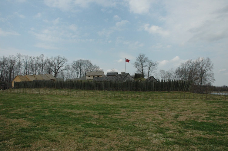
One of the first British outposts west of the Appalachians, built 1756
In 1756, with the French and Indian War under way, the British needed the Cherokee. Virginia's Braddock expedition had ended in disaster, and the Cherokee agreed to send 600 warriors to defend the colonial frontier if Virginia and South Carolina would build a fort to protect their families while the men were away. The Overhill Cherokee, living west of the Appalachians in what is now Tennessee, had invited such a fort years earlier. The result was Fort Loudoun, on the south bank of the Little Tennessee River near its meeting with the Tellico, one of the first significant British outposts beyond the mountains.
Its builders fought each other almost as hard as anyone. The engineer John William Gerard de Brahm and Captain Raymond Demeré argued over the site until, by Demeré's account, De Brahm offered him his pistol and invited Demeré to shoot him. They compromised. De Brahm drew an elaborate diamond-shaped fort with a cannon-mounted bastion at each corner, named for King George II, the Queen, the Prince of Wales and the Duke of Cumberland, its 300-foot walls ringed by a ditch planted with honey locust. On Christmas Eve 1756 he declared it essentially finished and left abruptly for South Carolina, and the Cherokees dubbed him the warrior who ran away in the night. Demeré, scornful, reported that the Cherokees called it a fort to put horses, cows and hogs in. He replaced the design with a single palisade of 15-foot logs, finished it in 1757, and handed command to his brother Paul. The fort was named for the Earl of Loudoun, then British commander-in-chief in North America.
For a while it worked. The garrison farmed 700 acres, hunted and fished, mended Cherokee guns at the forge, and bought fresh food from Cherokee women; some soldiers had Cherokee wives, and 60 women and children lived inside. But in 1758 fighting broke out between Cherokee warriors and frontier settlers, and after 16 Cherokee chiefs held hostage at Fort Prince George were killed in February 1760, the Cherokee besieged Fort Loudoun that March. By June the ration was a quart of corn for every three people. On 9 August 1760 the garrison surrendered, and 180 men with 60 women and children set out for South Carolina. The next day, near Tellico Plains, some 700 Cherokees attacked them, killing three officers, 23 soldiers and three women; most of the rest were taken captive and later ransomed.
The fort was rebuilt from De Brahm's and Demeré's descriptions and Works Progress Administration excavations in the 1930s, then moved and reconstructed above the waters of Tellico Lake, created in 1979. It is a National Historic Landmark and the heart of Fort Loudoun State Historic Park.
Other places on the map within a couple of hours.
