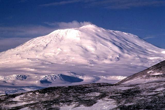
A lava lake that has been open since the 1970s, in the Antarctic
Mount Erebus, on Ross Island in the Ross Dependency, is the southernmost active volcano on Earth. Its summit stands at 3,792 metres, the second most prominent mountain in Antarctica after Mount Vinson, and it shares the island with three inactive volcanoes, Mount Terror, Mount Bird and Mount Terra Nova. James Clark Ross saw it in eruption on 27 January 1841 and named it and Mount Terror after his ships, HMS Erebus and HMS Terror, later lost on John Franklin's Arctic expedition. Members of Ernest Shackleton's party, Edgeworth David and Douglas Mawson among them, first reached the summit crater rim on 10 March 1908.
The volcano has been active for around 1.3 million years. In its inner summit crater sits a convecting lake of phonolite lava, one of five long-lasting lava lakes on Earth and present since at least the early 1970s, and Erebus is the world's only presently erupting phonolite volcano. The lake throws out Strombolian eruptions and degasses continuously, and McMurdo Station and Scott Base, about 35 km away on the same island, let scientists study it within hundreds of metres of the vents. Its emissions carry about 80 grams of gold vapour a day, which condenses into microscopic gold particles that have been found up to 1,000 kilometres away.
Gas escaping through the snow builds ice towers around fumaroles, and beneath them lie ice caves, moist and on average about 0 °C, with air of 80 to 100 percent humidity and up to 3 percent carbon dioxide. A study of three of them, including the completely dark Warren Cave, found microbial communities of bacteria and fungi, with no archaea detected, that most likely draw their carbon from the air and the volcano's own emissions rather than from sunlight, which makes the caves a natural laboratory for life in the dark.
On 28 November 1979 Air New Zealand Flight 901, a DC-10 sightseeing service from Auckland, flew into the mountain, killing all 257 people on board. Passengers' photographs taken seconds before the collision showed clear visibility beneath the cloud, with landmarks in view on either side; sunlight shining through the cloud from behind the aircraft left no shadows, and the mountain ahead vanished against the overcast in flat light. Investigation found a navigational error in the airline's flight documentation and a cover-up, and Air New Zealand made its last Antarctic flyover on 17 February 1980. Each summer, melting snow on the flanks still reveals wreckage that can be seen from the air.
Ross Island, Antarctica
See it on the map
Commons photos · Atlas Obscura · Britannica · GeoNames · OpenStreetMap
Other places on the map within a couple of hours.
